
Geomorphology
Tidal Flat Changes in the Venetian Lagoon
Erosion and sediment redistribution have altered the lagoon's shallow areas over recent decades, affecting water depth and bottom habitat availability.
Read article →The Venetian Lagoon is one of the most studied coastal ecosystems in Europe. Its shallow channels, tidal flats, and shifting salt gradients shape a fragile environment where human activity and natural processes intersect.

Articles
Three subject areas covered in detail: the physical transformation of tidal flats, the spatial structure of salinity, and ongoing biodiversity assessment.
Erosion and sediment redistribution have altered the lagoon's shallow areas over recent decades, affecting water depth and bottom habitat availability.
Read article →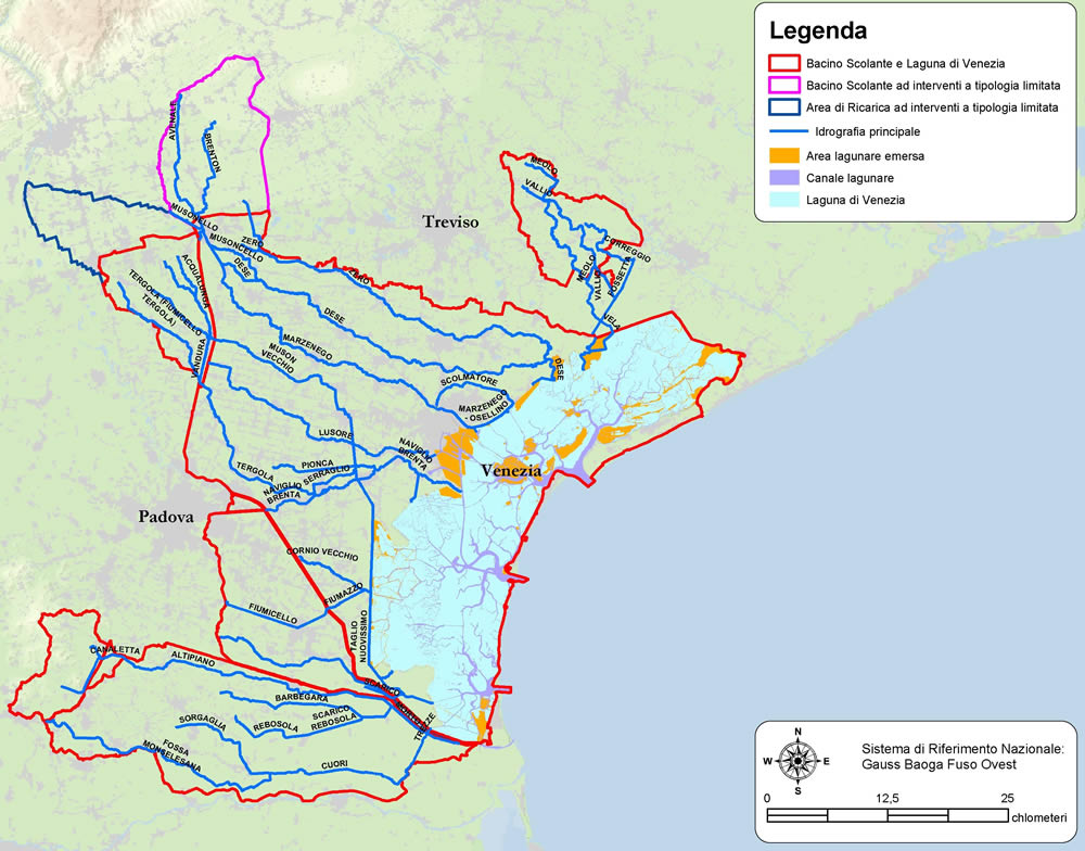
River inputs, tidal exchange, and industrial water use create distinct salinity zones across the lagoon, each supporting different communities of organisms.
Read article →
Long-term species surveys in the lagoon document changes in fish populations, benthic invertebrates, and aquatic vegetation since the mid-20th century.
Read article →Geography
The Venetian Lagoon covers roughly 550 km² and communicates with the Adriatic Sea through three natural inlets: Lido, Malamocco, and Chioggia. These openings govern the tidal cycle that drives water renewal across the basin.
The lagoon is separated into distinct northern, central, and southern sections by the positions of the inlets and the distribution of islands, barene (salt marshes), and velme (subtidal flats). The northern section receives the highest freshwater input from rivers including the Dese and Zero.
Since the 1960s, industrial development at Porto Marghera has altered the hydrology of the central and western areas. Dredging of navigation channels deepened parts of the lagoon that were historically shallow, changing the balance between erosion and deposition.

Water Conditions
Monitoring of the lagoon's water body covers physical, chemical, and biological variables recorded at fixed stations by Italian environmental agencies.
| Parameter | Monitoring Body | Typical Range | Notes |
|---|---|---|---|
| Salinity (PSU) | ARPA Veneto | 5–38 PSU | Wide gradient from river mouths to Adriatic inlets |
| Water temperature | CNR ISMAR | 4–30 °C | Extreme seasonal range in shallow areas |
| Dissolved oxygen | ARPA Veneto | Seasonally variable | Hypoxic events recorded in summer in southern basins |
| Turbidity | ISPRA Venice | Wind- and tide-dependent | Resuspension of fine sediments common in shallow flats |
| Chlorophyll-a | CNR ISMAR | Variable by zone | Phytoplankton blooms documented in spring |
Context
Several interconnected processes drive the ongoing transformation of the Venetian Lagoon's physical and biological character.
A combination of land subsidence and global mean sea level rise has increased the water depth in many parts of the lagoon over the past century. Subsidence at Porto Marghera was particularly pronounced during the industrial period.
Regulation of rivers entering the lagoon has reduced the natural supply of sediment. Without this input, tidal flats that historically maintained their elevation through sediment deposition have eroded and submerged.
The construction and maintenance of deep navigation channels for industrial shipping altered tidal flows within the lagoon, increasing water velocity in some corridors and reducing it in adjacent shallows.
View from the Lagoon
